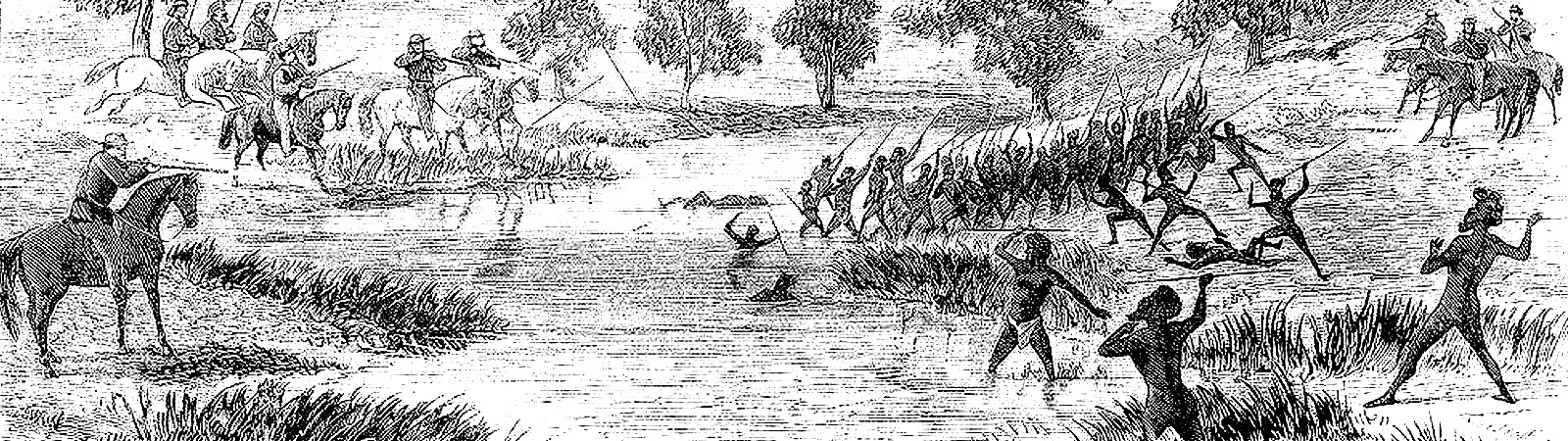
This project presents frontier conflict in south-eastern Queensland between the 1820s and 1850s.
Mapping Frontier Conflict in South-East Queensland
There has been on-going academic debate over the exact nature of Australia’s frontier wars. They have been portrayed as everything from low-scale crime waves (with either Europeans or Aboriginals at fault) to as well-organized genocides.
Historical mapping using the first view consigns the events to the realm of policing. Mapping with the second view offers us little more than a set of massacre sites.
The Centre aims to facilitate access to published and unpublished information for the period up to the 1850s, which represents an era of intercultural encounters.
This website embarks on a different angle, attempting to comprehend the frontier wars as social history and even as quasi-military history. A particular concern here is to correct the current vagueness over arenas of conflict by mapping specific affrays. Equally, the website seeks to create workable overviews of the conflict that will help us better understand how and why Aboriginal groups resisted in the manner they did.
About the project
This project has been developed from the research findings of Dr. Ray Kerkhove. It was built with a team of IT Masters students from Griffith University: Austin Odigie, Nkem Awujo, Hamed Bakhtiari and Saman Kayhanian.
Dr Kerkhove is currently a visiting Fellow at Griffith’s Harry Gentle Resource Centre, which is a digital portal of resources concerning the pre-Separation (pre-1859) history of Queensland. Ray’s speciality is the Aboriginal history and Aboriginal material culture of southern Queensland during the earliest decades of contact (1820s-1870s).
He has written and presented various public and conference talks, articles, reports and books in this field, often working with Aboriginal families on reviving and reconstructing specific aspects. A major interest of his has been creating overviews of the historical landscapes that would better illustrate Indigenous presence and provide a more inclusive overview of the conflicts and lifestyles of those times.
The current project aims to visually (digitally) present the resistance wars in south-eastern Queensland in an easily-digestible and informative manner, by combining maps, images and brief explanations. Dr Kerkhove seeks to better illustrate the typical lifestyle of settlers and Aboriginals caught in the resistance wars. He also seeks to develop historical maps that better reflect what was happening from an ‘Aboriginal resistance’ perspective.
Dr. Ray Kerkhove also published a book “Aboriginal Camp Sites of Greater Brisbane” which he described as the starting point to finding campsite locations.

